1-7-2000 (day 15)
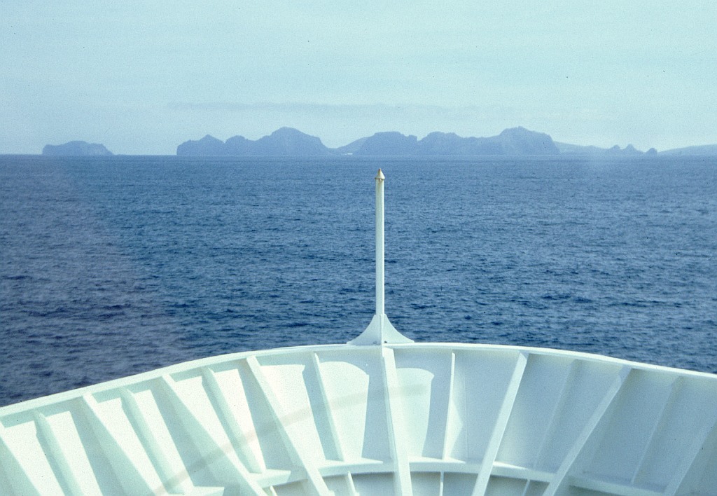 We took the bus to Þorlakshöfn so that we could catch the ferry to take us to Heimæy which is the main island of the Westman Islands, a row of volcanic islands to the south of the main land. One of those islands is the famous Surtsey, the island that only came out of the sea in I963. The ferry cost was 1500 Krona for one way. We had to wait a while for the ferry to arrive. I found out that the coffee here was only 50 Krona, so I had two. On the boat the price was also only 50, so I had another two and a beef sandwich for 280 Krona. The ferry started a bit late, they had some problems getting the cars out and in. That was my first time being on the high sea and it was not bad. The rolling motion doesn't seem to disturb me; I enjoyed both my coffees.
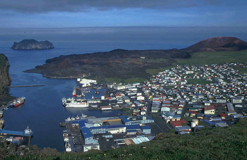 The entrance to the harbour at Heimaey is quite exciting with high rocks on one side and the stopped lava on the other. It is a very well protected harbour and in 1973 it nearly wasn't a harbour. The lava flow from Eldfell threatened to close off the entrance.
We walked straight up to the camp-site, with me only stopping at the shop to get more food. When we got to what we thought was the camp-site we found no tents and there was a note on the service block that said 'closed'. But we found the door to the kitchen open and decided to use the place. It was a nice place well out of town right up against the mountain.
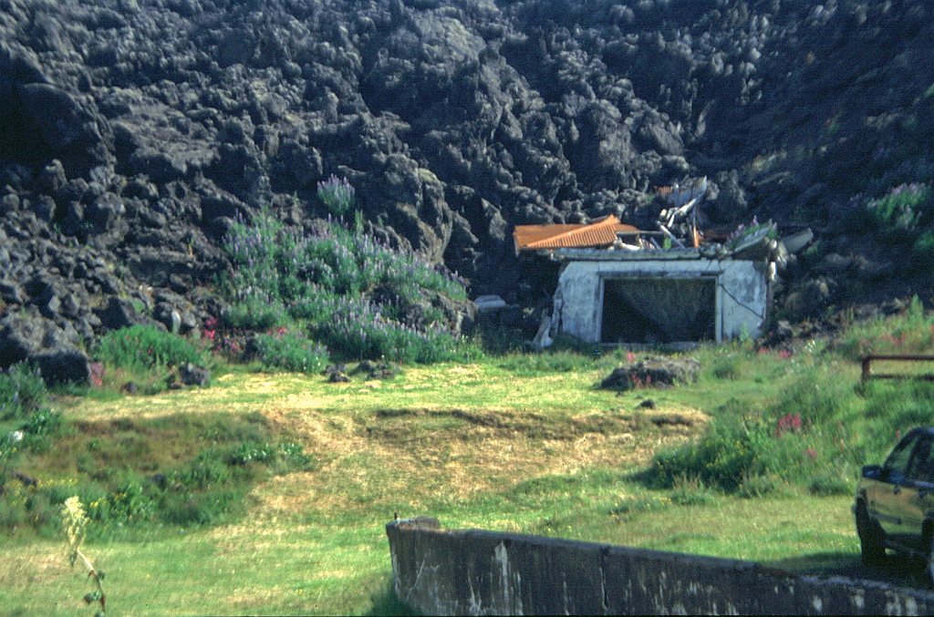
 For the evening we took in the film show that is all about the disaster of l973 when unexpectedly a fissure opened up emitting lava and ash. The lava nearly closed off the entrance top the harbour and flattened a number of houses and the ash destroyed or damaged many buildings.
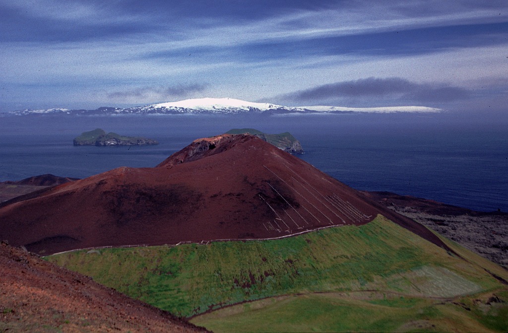
To get to the film show we took the long route around over the top of Fiskhellar (258m). The view from up there is superb; one can see the whole island and all the other islands of the group. Walking through town we thought of eating out but were somewhat put off by having to pay 500 - 600 Krona for a hamburger and chips or 600 - 1000 Krona for a pizza. So we skipped that one.
At 21h00 was the film show. We got there early before anybody else arrived and used their facilities for some ablution. Feeling like having a coke I chucked 150 Krona into the machine, but nothing came out, what a disappointment. And what was amazing, when the ticked lady arrived and l told her about my mishap she said, 'yes that happens at times, here, take another 150 Krona and try again', it worked. The film show was very interesting.
A short supper after that in the hut finished off the day.
1July
 Early hot shower to wash mud stains oft shorts. Walked by the river; then took the 10.15 bus via Stokkseyri and Eyrarbakki to Þorlakshöfn for the noon ferry Herjolfur Our two Alftavatn/ Hraftinnusker Germans disembarked as we got on, having had good weather on the Vestmannaeyjar (Westman Islands) oldest 'home' island of Heimaey. I watched diving kittiwakes, then a movie (Entropy). The islands are 10-12000 years old, made of alternate layers of palagonite tuff and lava, with basalt columns, coves and grottos. There are 15 islands and 30 rock stacks and skerries. There was a submarine eruption S-E of Hellisey in 1896, and a 4-year eruption from 14 November 1963 formed Surtsey. Eldfell erupted from 23.1 3.7.1973 and Heimaey grew by 2.1km2. Iceland's highest wind-speed was recorder here as 61m/sec (= 220 km/h). Guillemots, gannets, kittiwakes, Iceland gulls, and lots of puffins - 20cm long, 55cm wingspan, 500g, 25-35 year lifespan, flies 80km/h, dives 10m - 60m max. 150 plants, 80 insects, cod, haddock, plaice, dab, halibut, herring, capelin, lobster; ocean perch, seals, small whales etc.
Irish monks settled before 875AD, but the islands were named for the Irish or British slaves who escaped and killed Hiorliefir Hroomarsson (an initial Icelandic settler; with Ingolfur Amarson) and were then pursued and slain. There is now a 40km, 5 000!/day water pipeline from the mainland 8k north of Ellioaey.
From Heimaey harbour, Horst went shopping then we walked to the old camp site, which was empty but had electricity and hot water in the kitchen. We ate, climbed to the ridge of 273m Blatindur; descended into town (I visited a seagull's cliff nest) walked along by the new lava flow to the harbour mouth, then watched the documentary film about island history and the 1973 eruption. Fishing, netting puffins for meat, cliff swinging for seagull eggs. They lost 55 (one third of their) fishermen at sea in 1680 or so. In 1627, three Algerian ships raided, killing 34 men and taking 242 men, women and children away as slaves - prompting a Helgafell lookout and some harbour defences. I walked across the golf course to the Utah (Mormon) monument before bed.
2-7-2000 (day 16)
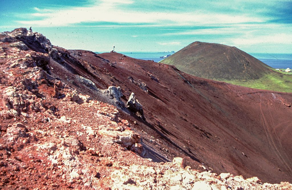
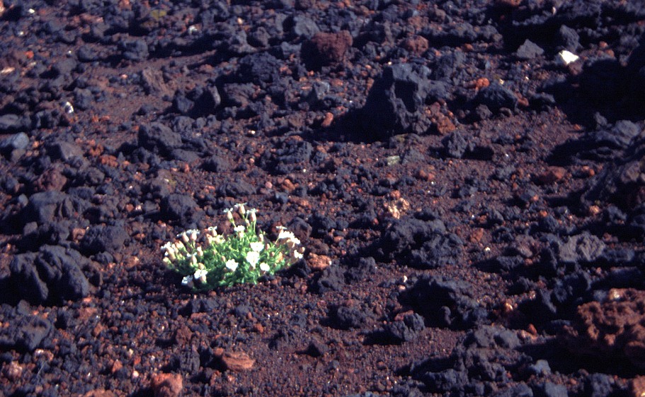 We planned to walk around town, to the top of both craters, further down the island and back up the other side. Eldfell (205m) is the volcano that caused all the trouble. It is actually only half a volcano; during the eruption the whole of the north side detached itself and floated on the lava down to the harbour. That piece of wall can still be seen further down towards the harbour. The crater is still warm and there are a number of places where it is still steaming. Scratch the surface for an inch or two and the surface feels distinctly warm.
After collecting a few pieces of lava we made our way over to Helgafell (225m). Also a volcano, but it has not erupted since people have been living on the island. It has the typical-shape of a volcano with a shallow crater. This served as a lunch spot; it was partially out of the wind. From here one could also clearly see the remains of the initial fissure that had opened up in 1973.
 Our route on took us past the airport and we thought that we should stop to ask about flights to Reykjavik. It would save us some time. The price for a single ticket was 4500 Krona, comparing this to the about 2000 Krona it would cost us for the ferry and bus; there was thus no contest.
The round was completed by climbing the hill behind the airport (176m) and then cutting across to the other side of the island and return to our tent. We had also found out today why we are the only campers. A notice at the airport informed us that the camp-site has been moved to a space closer to town. This didn't bother us too much; we were on a nice and much cheaper camp-site and planed to stay there. After dinner, at l8h00, Jim decided that he must climb
up to the top of Hennaklettur (279m), the highest point of the island. That there was actually a sign saying that one shouldn't climb up because of the danger of rock falls didn't deter him. I didn't feel that strong and whilst he did that I went around to the ferry to see what exact time it will be leaving in the morning. Just as well, I had 08h55 in my head whilst the actual was 08h15.
Just a general observation, it's a small island, 6 by 3 kilometers, but everybody seems to have a car. If I were living on there I would at the most just have a car stationed on the mainland.
2.July
Walked after breakfast. through town to Eldfell s lava field. At 1.50am on 23.1.73. a 1600m volcanic rift opened. By 31.1 the town had 4m of ash, and the rift had become one volcano. On 20.2 it split and a 'vagabond' drifted north. On 26.3 there was fast lava and a new vagabond. On 1.4 the lava edge stopped, and all was over by 3.7.73. There had been 20m m3 of ash and 250m m3 of lava. adding 2.2 km2 of land area and destroying 360 (30% of the) houses. They used 5.5m tons of water controlling the lava. and moved 1.5m tons of ash.
We climbed 206m Eldfell, whose slopes steam where you've walked - the ground is hot an inch down - then lunched on top of the older 226m Helgafell. Down by the airfield, up another ridge. then down and back along the west coast to camp. After reading and supper; we went off into town again and I climbed 283m Heimaklettur ('closed' because of slippage risks) and looked down on Keiko's enclosure beyond. The harbour had incoming rock salt and lots of fish/salt bins, and football-tour schoolboys were swinging on a cliff rope.
3-7-2000 (day 17)
We managed to wake up at about 6h30 and had time for a short breakfast before trundling down to the harbour. On the boat with us were millions of kids, they were the participants in a 6-a-side soccer championship over the weekend. We had seen them in action there.
The boat trip was very smooth. I again had two coffees and Jim watched some film. In Þorlakshöfn the bus to take us to Reykjavik was waiting and full, I had some trouble getting my rucksack loaded. Cost of the fare 700 Krona.
From the bus station in Reykjavik we walked over to the camping site. Jim had inquired at the station of whether we could camp there, request denied. But I had seen a couple of tents behind the bushes just behind the station, perhaps they weren't aware of that. The tent was quickly put up on a horrible spot decided on by Jim being very determined not to allow me to chose the spot.
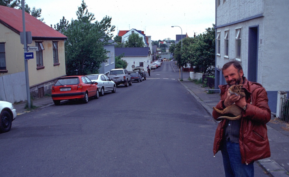 A walk through the town rounded off the day. We bought a few souvenirs but resisted the temptation to have something to eat and drink. Macdonald's was advertising a hamburger and a coke for 499 Krona, coffee we saw for 250 Krona. This would hurt too much.
In the evening we had interesting company around the dinner table. A young girl from Austria, a glaciologist from Italy and a volcanologist also from Italy. We managed to get many of our questions re glaciers and volcanoes answered. It was well past midnight before we turned in.
3.July
onto the 8:10 am ferry to watch Phantom Menace Star Wars standing up, then by bus to Reykjavik to hike fully-laden across town to the campsite for lunch. Then we explored the main pedestrian shopping street and Hallgrims church, and came back for a long evening of blathering with Hebe the Austrian art historian and two Italians, a glaciologist and a vulcanologist. Compared rock samples - basic lava gives black pumice, but after cooking with other rocks it gets more acidic and gives white pumice. Pumice is early upper gassy eruption. Obsidian is acidic and viscous. My Eldjell samples were sulphur; barjvtes, haematite crystals. Scoria come from the top of the magma chamber; by explosion then outgassing. Browner lumps of basalt are from later in the eruption. Rhyolite (acidic magma) gives pumice, coloured samples, obsidian. Water entering the magma brings up light-coloured minerals - yellow (or green copper). Basalt with white crystals - zeolite (all silicate).
4-7-2000 (day 18)
We slept in a bit until 8h00. After a lengthy breakfast we walked over to the Botanical Garden just behind the camping ground. Of interest was an old washing place, used by the woman of the town. Some of the troughs and buildings are still standing. Later on the water was tapped into to use for heating of the town, which is possibly also why the washing place fell into disuse. The garden itself was interesting, well labelled. But to really enjoy it one should spend lots of time in there preferably with a book that lists the entire local flora.
Next stop was the Kringlan shopping center. It's the equivalent of East Gate, just not as large. After looking at all the shops we descended onto the supermarket. It was mainly for my benefit, because I had this desire to take along as many tubes of Kaviar as I could.
At lunch we were back at camp. And to finish off the day we went next door to the swimming pool. The entrance fee was 200 Krona and for that we sat in the hot polls for a number of hours.
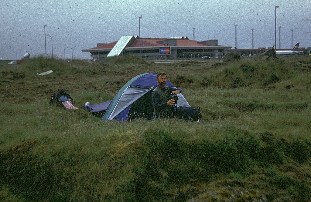 And finally we packed the tent, walked to the bus station caught the last bus to the airport and put up tent there. This was because there was no bus early in the morning to catch our flight to Glasgow so we decided to camp at the airport. Our first attempt to camp next to the car park was halted by airport security. But at least he was friendly enough to tell us to just move over to the other side of the road. The terrain was very rocky (lava flow) and we had a bit of a problem finding a spot.
4 July
Capelin caviar; bread and smjor: Apricot jam, rye bread and smjort Porridge, mint tea and sugar: Sewed on weskit button. Walked via old washhouse to nearby botanical garden, then over to the large Kringlan shopping mall for a T-shirt and more food supplies. Back to camp to read, then to Laugadal hot pools for soaking and snoozing. Packed up camp at 4pm to hike to the bus station for the (strike breaking) bus along the coast road to Keflavik town and airport, where we put up the tent in the car park then had to move it out to the mossy lava across the road by a Nato-base fence.
continue to Scotland
return to home page
 We took the bus to Þorlakshöfn so that we could catch the ferry to take us to Heimæy which is the main island of the Westman Islands, a row of volcanic islands to the south of the main land. One of those islands is the famous Surtsey, the island that only came out of the sea in I963. The ferry cost was 1500 Krona for one way. We had to wait a while for the ferry to arrive. I found out that the coffee here was only 50 Krona, so I had two. On the boat the price was also only 50, so I had another two and a beef sandwich for 280 Krona. The ferry started a bit late, they had some problems getting the cars out and in. That was my first time being on the high sea and it was not bad. The rolling motion doesn't seem to disturb me; I enjoyed both my coffees.
 The entrance to the harbour at Heimaey is quite exciting with high rocks on one side and the stopped lava on the other. It is a very well protected harbour and in 1973 it nearly wasn't a harbour. The lava flow from Eldfell threatened to close off the entrance.
 For the evening we took in the film show that is all about the disaster of l973 when unexpectedly a fissure opened up emitting lava and ash. The lava nearly closed off the entrance top the harbour and flattened a number of houses and the ash destroyed or damaged many buildings.
 Early hot shower to wash mud stains oft shorts. Walked by the river; then took the 10.15 bus via Stokkseyri and Eyrarbakki to Þorlakshöfn for the noon ferry Herjolfur Our two Alftavatn/ Hraftinnusker Germans disembarked as we got on, having had good weather on the Vestmannaeyjar (Westman Islands) oldest 'home' island of Heimaey. I watched diving kittiwakes, then a movie (Entropy). The islands are 10-12000 years old, made of alternate layers of palagonite tuff and lava, with basalt columns, coves and grottos. There are 15 islands and 30 rock stacks and skerries. There was a submarine eruption S-E of Hellisey in 1896, and a 4-year eruption from 14 November 1963 formed Surtsey. Eldfell erupted from 23.1 3.7.1973 and Heimaey grew by 2.1km2. Iceland's highest wind-speed was recorder here as 61m/sec (= 220 km/h). Guillemots, gannets, kittiwakes, Iceland gulls, and lots of puffins - 20cm long, 55cm wingspan, 500g, 25-35 year lifespan, flies 80km/h, dives 10m - 60m max. 150 plants, 80 insects, cod, haddock, plaice, dab, halibut, herring, capelin, lobster; ocean perch, seals, small whales etc.
 We planned to walk around town, to the top of both craters, further down the island and back up the other side. Eldfell (205m) is the volcano that caused all the trouble. It is actually only half a volcano; during the eruption the whole of the north side detached itself and floated on the lava down to the harbour. That piece of wall can still be seen further down towards the harbour. The crater is still warm and there are a number of places where it is still steaming. Scratch the surface for an inch or two and the surface feels distinctly warm.
  Our route on took us past the airport and we thought that we should stop to ask about flights to Reykjavik. It would save us some time. The price for a single ticket was 4500 Krona, comparing this to the about 2000 Krona it would cost us for the ferry and bus; there was thus no contest.
 A walk through the town rounded off the day. We bought a few souvenirs but resisted the temptation to have something to eat and drink. Macdonald's was advertising a hamburger and a coke for 499 Krona, coffee we saw for 250 Krona. This would hurt too much.
 And finally we packed the tent, walked to the bus station caught the last bus to the airport and put up tent there. This was because there was no bus early in the morning to catch our flight to Glasgow so we decided to camp at the airport. Our first attempt to camp next to the car park was halted by airport security. But at least he was friendly enough to tell us to just move over to the other side of the road. The terrain was very rocky (lava flow) and we had a bit of a problem finding a spot.